Basic visualizations of statistics from the 2021 Canadian Census.
Diocese of Saint John 2021 Profile
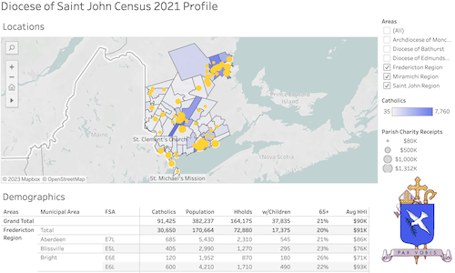
- Diocese of Saint John Census 2021 Profile tab
- Map of Diocesan parish churches represented as circles sized by annual charitable receipts reported to the Canada Revenue Agency
- Postal code areas shaded by estimated population of those area citizens identifying as Catholic in the long form Statistics Canada Census issued to 1 in 4 households
- Table of summary statistics of Diocesan regions (Saint John, Fredericton, Miramichi), and municipal and postal code areas
- A filter control is available to select a particular Diocesan region, or other New Brunswick dioceses for comparison
- Diocese of Saint John Charity Profile tab
- Table of Parish Charity recipts by region, as reported to the Canada Revenue Agency for the full year 2021
- Charitable Giving by region, municipal, and postal code areas, as reported by income tax filers
- References tab
- References, definitions, and data sources
- Exploring Tableau maps
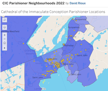
Cathedral of the Immaculate Conception Parishioner Neighbourhoods Map
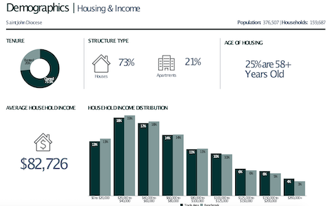
Demographics report of the Diocesan area, from the 2011 National Household Survey